Wilson R.M. Krukoski * (Translated by Jenifer Barros)
1) INTRODUCTION
The case raised by Uruguay in 1934 about the demarcation of a small stretch for this border with Brazil in the so called "Rincão de Artigas", has been discussed for more than 70 years, most of the time without the complete knowledge of the subject by eventual interested people form both countries.
Therefore, this brief note was organized, in order to facilitate information to those that really want to know the historical facts.
Initially it is convenient to remember that, to establish an international border, normally four distinct stages are covered: 1"Historical Precedents", 2"Delimitation", 3"Demarcation" and 4"Characterization"
To the case of the borders between Brazil and Uruguay we must consider that in the "Historical Precedents" Uruguay´s very beginning, a country whose origin suffered great Portuguese influence since its foundation in XVII century, when, quite simultaneously
to what was done to Colônia de Sacramento (a Portuguese occupation that last more than a century) and to Montevideu. Brazil-Colony always have had great influence in the Oriental subjects. Thus, when the independence of Brazil took place, Provínce of Montevideu or Cisplatina was incorporated to Brazil, and it has only become an independent nation by Preliminary Convention for Peace of 1828 (which had not especified where the limits should go through - depending "of what would be ajusted in a definiti treaty"). By the Convention of 1819 - just before the incorporation (in 1821), - the northwest limit of Cisplatina with Rio Grande de São Pedro was defined by Arapey River (at south of the current limit).
In the other hand, Madrid Treaty (1750), as well as Santo Ildefonso Treaty(1777), between Portugal and Spain, used to delimitate the northwest border by Ibicuí River. Although, in the coast, the first of theses treaties had started the line by Castillos Grandes, south of Chuí.
As a consequence of the incorporation of Cisplatina, the Brazilians in Província of Rio Grande occupied part of lands by north of Uruguay until the Arapey River (there was, then, the border).
The lands located between the rivers Ibicuí and Arapeí, also known as part of the Oriental Missions, created pretensions and divergences between Uruguayan and Riograndenses, for a long time; frequently following a "marginal diplomacy", besides the Imperial Governmet, even though, arising against the Treaty of Limits. The Treaty of Limits, signed in 1851, the current one "delimitated" the border, in this region, through Quarai River.
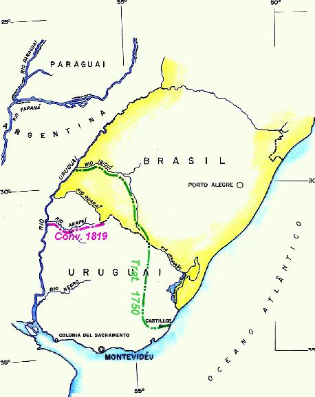
2) HISTORICAL ABSTRACT (After the signature of the 1851 Treaty)
Once the Treaty of Limits was signed, it passed to the phase of "Demarcation". Once the Delegates were nominated - Barão de Caçapava by Brazil, and Coronel Reyes by Uruguay - the works initiated in 1853, through the region of Chuy.
In the region we are studying - the area known as Rincão de Artigas - the works developed from 1856 through 1862, in obedience to what was established in the 2º Item of the Article III of the Treaty that says: "... goes on in that coxilha, and find that one of Haedo, until the point where the Quarahim´s twig starts, the so called arroio da Invernada by the chart of Visconde de S. Leopoldo, and without name by coronel Reyes´s chart, and goes down through twig until it enters Uruguay River; islands that are found in the mouth of the Quarahim River in Uruguay, belongs to Brazil."
Let´s see how these charts were presented
Chart of Viscount of São Leopoldo (Twig of Quarai called arroio da Invernada)
Chart of Coronel Reyes - Original Scale, aprox. 1:585.000 (twig of Quarai "without name")
Let´s compare this chart with a current map of the region, in a closed escale.
Current Map of the Region - Esc. 1:500.000
The coincidence of the meeting of coxilha of Haedo with coxilha Negra, in the furthest southern of arroio Invernada (known as Masoller) must be noted. We also must note that the arroio "without name" in Coronel Reyes´ chart (not the arroio "Sepulturas") is present itself in a position that it only can be seen as the arroio Invernada in the current cartography.
To the demarcaters would be then, the delicate task of identifying the land of
arroio that, without name in Coronel Reyes´cartography, used to correspond to the Invernada in the São Leopoldo´s chart. Examining carefully both maps, is verified that the criteria adopted by the demarcaters was correctly done - in both maps, the common detail of the place where both courses of waters starts: the meeting point of both coxilhas, the Haedo´s and the Belém´s, place that was chosen by them to constitute the end of the limit in the "dry line" (throughout coxilha) and the initial point of the fluvial limit, that would end in the mouth of Quaraí River in Uruguay, was correct.
Let´s see how the works were developed. Summarizing,
we verify that four acts were officialy signed :
- In June 15, 1853 - 1st Act. According to the limit line in the region of Chuy. - In April 6th, 1856 - 2nd Act. Describing the limit line in Jaguarão, Arroio da Mina, Aceguá, São Luiz, Serrilhada and Coxilha de Santa Anna. - In April 28, 1856 - 3rd Act. According to the limit in the region of Arroio Invernada. - In April 1st/6th, 1857 - 4ª Act. Treating about the region of two straight lines in Aceguá and São Luiz.
Observing the 3ª Act, the one that we are interested in, we can see that the Delegates had agreed about the limit line: "... ficava definitivamente acordado - it was definitively accorded: 1º Que continuando a divisa, como há sido declarado, pelos mais altos níveis da Coxilha de Haedo - by the highlands of Coxilha of Haedo, desde que ela se separa da de Santa Anna, até as vertentes do Arroio Invernada, descerá a linha pelo galho mais ocidental, conhecido pelo do Maneco, preferindo-se, com o mais forte, o ramal que nasce da mencionada Coxilha de Haedo, em frente a Estância ..., e a Este da volta que formam em sua união as supracitadas coxilhas de Belém e Haedo - in its union of said Coxilha of Belem and Haedo, conhecida também por Coxilha Negra; e próximo a casa de ...; continuando esse galho até encontrar, mais abaixo uma vertente forte e permanente, chamada Galho dos Gravatás, e em seguida muitos outros tributários, que o enriquecem com suas águas, até sua confluência no Arroio Invernada, por cujas águas continuará a linha até a sua foz no rio Quarai, acima do arroio Sepultura. 2º Que, em conformidade com o mesmo Tratado, a linha seguirá pelas águas do Quarai ...; 3º Que, para demonstrar com maior clareza a linha demarcada, se traçará nas plantas ou cartas das respectivas comissões, autenticadas pelos senhores comissários, que também se obrigam a exata colocação dos marcos de limites ...".
Barão de Caçapava left abundant documentation (letters and reports) detailing all the problems found, divergences and agreements made to fulfill what was established in the Treaty.
Let´s see what Barão left written when he referred to the stretch we are studying. In a "Brief Exposition", made in March, 1857, so wrote the Barão, explaning how these works were done: "... Seguiu-se a questão do arroio da Invernada - followed the question of the Invernada -. Mandei primeiro fazer o reconhecimento deste terreno, e depois fui pessoalmente examinar todo o espaço compreendido entre o Quaraim principal e as águas do Invernada. O comissário oriental fez da sua parte os reconhecimentos que precisava, e depressa nos entendemos - and quickly we got to an understanding -, firmando por uma outra Acta - signing another Acta -, que assinamos, toda a fronteira desde as cabeceiras do S. Luiz no lugar próximo ao Cemitério até a confluência do Invernada no Quaraim principal; e ficando sobre a Coxilha de Haedo bem determinado o ponto sobre a mesma coxilha, que corresponde à vertente principal do arroio da Invernada - whicçh corresponds to the main starts of arroio Invernada. Esta vertente está bem colocada na carta do falecido Sr. Visconde de S. Leopoldo.
Examining the documents left by Barão, we verify that in this part of the border there was not any discussion about the establishment of the limit line, whereas we cannot say the same in various other strechts, there were great discussions about the choise of the line to be demarcated - as was in the Chuy region (south of Lagoa Mirim), in the so called "canhada dos Burros" (east side of Aceguá) and in the choise of the starts of São Luiz and mainly in the establishment of the two straight lines that should be traced in that region (Aceguá and São Luiz).
To the agreement of these straight lines, the subject was very much discussed and it was solved in the following year (1857), with the signature of a 4th Act - that really was firmed separately (that´s why there are two dates, in April 1st Barão signed it, and in April 6th Coronel Reyes signed it)
3) EXCHANGE TREATY (That was not ratified)
A subject that sometimes confuses the observers of the occurance of that time was the attempting of switching lands, tried by the Delegates.
When the works of demarcation, in 1855, arrived in the region where nowadays we find the cities of Sant'Ana do Livramento (Brazil) and Rivera (Uruguay), there was only the Brazilian town, that it was extended by both flanks of the coxilha (Livramento was raised and recognized as a village in February 1857). The Delegates proposed to keep this place with the Brazilian occupation only. Therefore, in September 1857 an Exchange Treaty was signed between Brazil and Uruguay. It was intended to switch the frontal area of Sant'Ana do Livramento Village, until the arroio de Cunhaperú, for an equivalent area, located in the western of coxilha de Haedo (the region of Rincão de Artigas).
The region being studied can be seen in the picture below.
Project of the Permuta Treaty "Cuñaperu" (1) by the "Rincão of Maneco" (2)
The Delegates that were constructing the landmarks throughout the limit line, built a big landmark (Main Landmark 12-P) at southeast of Livramento, in one of the extremes of that. The big landmarks, called Main Landmarks, were constructed in places where the border line should change of regime, as well as the landmarks 2-P and 3-P by the extremes of the straight line of Chuy, 8-P and 10-P by the straight line of Aceguá, 11-P in Serrilhada, the beggining of the division of waters of the Coxilha de Santana, the dry line.
The Exchange Treaty was suspended for a while, because the Uruguayan legislative denied to retified it (in October 1857, an "Adicional Declaration" was made to facilitate the exchange).
Meanwhile, in May/June 1860 the Uruguayans started to build a town, right in front of Livramento, that initially was called "Zeballos", later on "Rivera".
Finally, in February/May 1861, the Treaty was considered rejected by Uruguay and then cancelled. Since then, this issue was not considered anymore. The Uruguayan city, Rivera, developed, always intimately related to Sant'Ana do Livramento.
Let´s remember an event, not directly related to our theme, but very appropriate to indicate the predominant understanding in the region. It is about the Masoller Battle, in the beggining of the XX century.
One of frequent revolts was happening in Uruguay by that time. On one side forces of the central government ("colorado"), in the other side, the rebels "blancos", leaded by Aparício Saraiva (this caudilho, just as many frontiersmen of that time, had already followed his brother, Gumercindo Saraiva, in incursion through Brazil, following the Federalist Revolution of 1894, in Brazil).
After a battle in the region of Masoller, Aparicio was wounded and took refuge in Brazil, in Coronel João Francisco´s mother´s farm (this Coronel was known as "hiena of Catí").
In the "Farm of Rincão", located in the area that was object of the Exchange Treaty (see map), and that nowadays is questioned by Uruguay, the famous caudilho "blanco" died and was buried there.
Many years later, in 1921, his body was transferred to Uruguay, in a great civic solemnity. The problem started to exist
in 1934.
5) THE BEGGINING OF THE URUGUYAN QUESTIONING - 1934
The border's works were followed normally. In 1933, the technician were carrying through, in a mixed comission, the works of maintenance and improvement of "Characterization" in the region of coxilha de Santana, when an Uruguayan officer (Coronel Vila Sere) decided to question the correct localization of the last landmarks placed by the demarcation of the 1851 Treaty.
The works were done according to what was established in the new diplomatic document - the "Convention to improve the Characterization of the Frontier" on December 27, 1916, that said textualy: "... to improve the characterization ... in places of Passo Real do Chuy to the Passo Geral do S.Miguel, and from the international Mark of Acegua to the 49 small mark, built in the arroio Invernada, in the beggining of Quarai river, ... should be repared the old marks in bad conditions and construct new intermediate marks ...".
The Uruguayan officer "discovered" that the Delegates of the Treaty in 1860 could have done a mistake when the arroio Invernada was chosen, shown in the charts and cited in the Treaty, wrongly placing the 49th landmark. Arroio Invernada would be, in his opinion, an arroio called by brazilians Moirões, an arm of arroio dos Trilhos (among the landmarks Intercalados 46th and 47th) (see the previous map). The arroio chosen by the landmarkers would have been arroio Maneco.
That "discovery" was accepted by an Uruguayan geographer (Elzear S.Giuffra), who made many conferences raising the problem. The illustrious geographer found very strange that the border line, following a general alignment from southeast through northwest inflected brusquely to south (this was his great argument).
At that time many divergences happened among civil authorities and militaries from Uruguay, about the preponderance and military chief, in conducting the demarcation works by Uruguayan delegation, in the Mixed Comission field.
The object of the bad location for the landmarks at "dry line" was officially stated to the Brazilian government by the Minister of the Foreign Affairs of Uruguay (Jose Arteaga) through the August 10, 1934 Note, that read
"una determinación científica - a cientific determination - del curso de agua que en el articulo 3 del Tratado ... se denominó por Arroyo de la Invernada" is required.
The Brazilian government replied through an Note, on october 26, 1934, saying that the works that were been donne now, searching for a better and more visible boarder line ("Characterization" works), not being viable any interpretation or attempt of rectifying the line that was already fixed by the Treaty (it would already finished the phase of "demarcation"). Other 78 years elapsed since the Treaty started to work out, no doubts appeared about the interpretation of the cited article.
Since then, other Uruguayan notes, sporadically, showed up (as in 1937, 1938 and in 1941) insisting about the same "científic determinación".
In 1966 a controversy between Coronel Vico and Ambassador Buero about the subject, appeared in the newspaper "La Mañana" (both of them were Uruguayans).
The Uruguayan government stated a Decree in 1974, that official maps should show "questioned limits" the area located between the intermediate landmarks 941 (located between landmarks 46-I e 47-I) and the last landmark of coxilha de Santana, in Masoller, landmark 49-I (see the map).
A new Uruguayan note in 1985, complaining about the construction of Albornoz Village was replied in 1986, following basically the same Uruguayan arguments and the same Brazilian questioning.
Before we approach the last notes exchanged between Brazil and Uruguay about the subject it´s interesting to observe official diplomatic documents, where the border landmark - 49-I - is mentioned, since it was placed in 1862 now being questioned:
- December of 1916 "Convention to improve the Characterization of the Frontier" (we have already seen the text).
- January of 1920 "Instruction to the Mixed Commission", in the 2nd article says: "Os delegados ... examinarão todos os marcos ... nos trechos ... e do nono marco da coxilha do Aceguá ao 49º marco pequeno, situado no arroio Invernada, e também ..."
- June of 1927 "Verbal Note of the Ministro das Relações Exteriores do Uruguai" says "... estudiado con la debida atención el nuevo Proyeto de Instruciones... del trecho de frontera comprendido entre la Cerrillada y Masoller, ..."
- December of 1927 "Ajusted by a Change of Verbal Notes", it says, in the introduction "... para la caracterización de la zona de frontera comprendida entre el marco 11 Principal y el marco 49 Inermédio; ...". In the 6th item it repeats "... la linea llamada seca (marco 11 Grande - Masoller) ..."
- April of 1928 "Special Instructions Projet", it says "... segundo os termos do mencionado artigo toda a extensão da linha chamada seca (Marco 11 Grande - Masoller)"
- December of 1933 "The Border Law Statute", in its article IX - "Paralelamente a los segmentos rectilineos que constituyen la linea divisoria entre el marco 11 principal y 49 intermédio, ..."
We must remember these facts having in mind what is established by the Viena Convention of 1969 - or "Law of the Treaties". It says, textually where it refers to the interpretation of Treaties: "art. 31 - General rule of interpretation. Item 3. There shall be taken into account, together with the context: (a) any subsequent agreement between the parties regarding the interpretation of the traty or the applicationof its provision; (b) any subsequent practice in the application of the traty which estalishes the agreement of the parties regarding its interpretation;"
7) LAST NOTES ABOUT THE SUBJECT - 1988
The last notes switched between Brazil and Uruguay about this subject are:
- Uruguay's Note, August 17, 1988(this note came followed by two others with the same date; one about to study how are waters in the stuary of Quarai in river Uruguay, and the other note is about the exploitation of the Quaraí River’s waters.). The Uruguayan note about Rincão de Artigas was replied as it follows:
- Brazil´s note number 272 Dezembro 4th, 1989, contesting all the Uruguay´s arguments. In that note Brazil accused had received the Uruguayan note, "...sem acrescentar novos dados" and said that have "sempre manifestado ao Ministério das Relações Exteriores uruguaio o que é uma posição oficial e permanente do Governo Brasileiro".
SINCE THEN, URUGUAY NO MORE CONTESTED THIS SUBJECT.
8) CONCLUSION
According to what we have exposed the Uruguayan pretension is impossible to be accepted by Brazil, not only because of the inconvenience of the diplomatic precedent of border whishes, totally improper, but also because of the certainty of being right about the argument presented, and the most part of Uruguayan authorities knows that.
But why did they insist in this question? That does not enlarge the relations between both countries, with so good interaction between their boundaries habitants. Specially at a time to improve and to integrate the relations of Mercosul.
Besides the pretension of inconseqüents "patriotadas" two ideas still persist by uruguains:
1.- They hope that a second Rio Branco will show up, being able to convince the nation about fairness of the cession of a part of the Brazilian territory, as it already happened, in 1909 through the reversion of part of lagoa Mirim's waters and of Jaguarão River.
2.- The thought, kind of illogical, that once Brazil is such a big country (8,5 millions of squared kilometers) a small portion (220 squared kilomers) wouldn´t be that important.
However, to the first idea, it´s convenient to remember that the reversion was basically forseen, since the signature of the 1851 Treaty (the limit line by that treaty, it ran by the occidental edge of Lagoa Mirim), but anyways a new Treaty to correct the limit line was necessary (in order to definite a new "delimitation").
The second one is such an insane idea that it does not deserve to be commented.
So we always hope that Uruguay, that raised this problem unilaterally, rectifies its position someday, cancelling the 1974 decree and be able to forget this so inconvenient issue once for all, for two countries that always had a friendly relation.
-----------------------
* - This work represents the author´s thought and a result of his researches and study about the subject. See other case about "Demarcation and Border" raised by Uruguay - lha Brasileira.
- More information about BORDERS AND LIMITS OF BRAZIL can be found at the following website: http://info.lncc.br/indexi.